Critical Weather Definitions
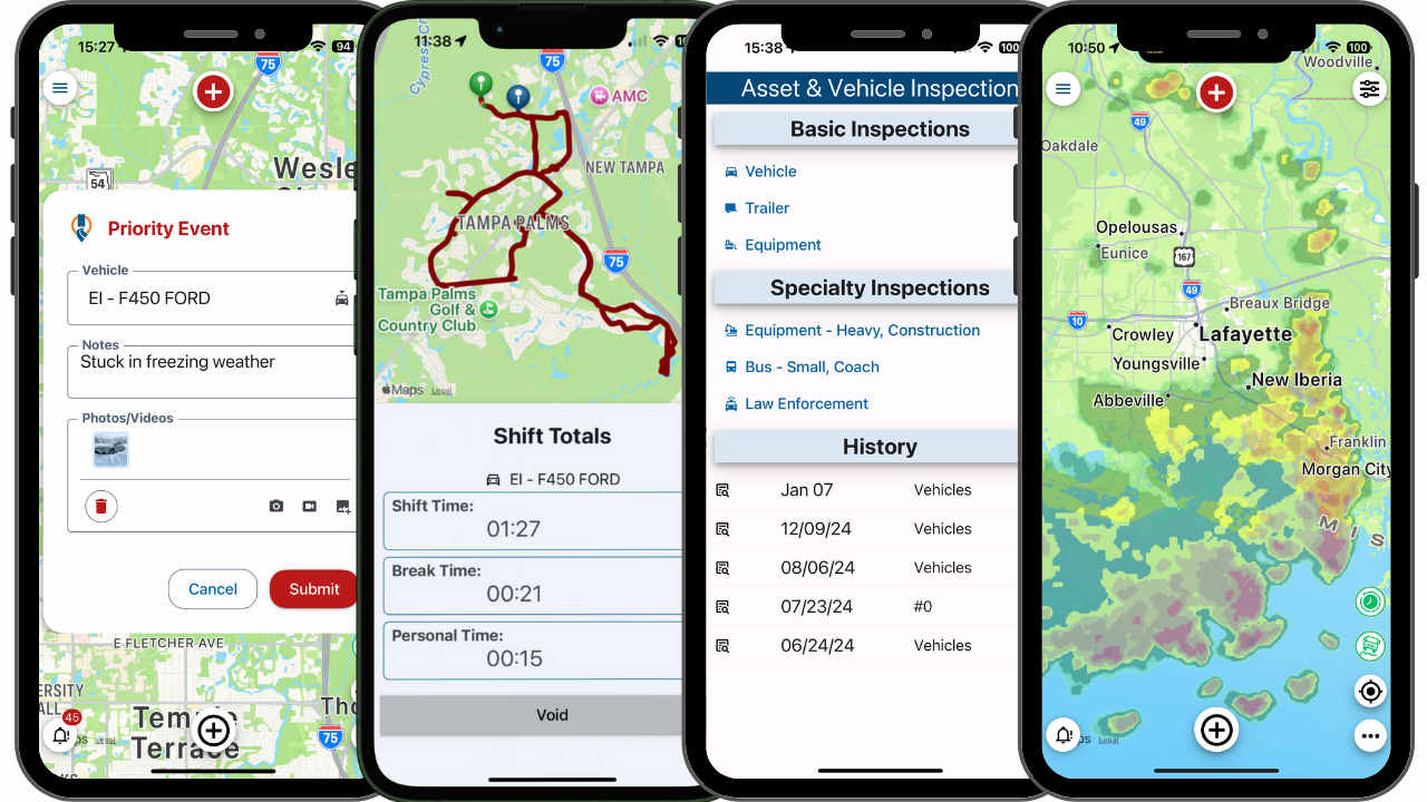
Current Weather Layers
♦Driver, Current Driver Weather
For those who need to make driving and operational decisions based on current road conditions, this product displays whether roads are wet, flooded, or affected by ice or snow. Poor road conditions due to weather are a leading cause of traffic accidents and many organizations rely on road condition reports to make operational decisions. Applications include all forms of ground transportation, emergency personnel preparedness, and validating insurance claims. Road weather products are also ideal for display and alerting applications in onboard telematics systems.
- Resolution: 7 km
- Update frequency: 1 minute
- Range: CONUS
♦Lightning
Comprised of data supplied by Earth Networks Total Lightning Network (ENTLN), this product provides highly accurate lightning detection, including polarity and severity. It gives users a quick visual for severe weather tracking and determining the potential risk to life and property.
- Resolution: by strike
- Update frequency: real-time
- Range: CONUS
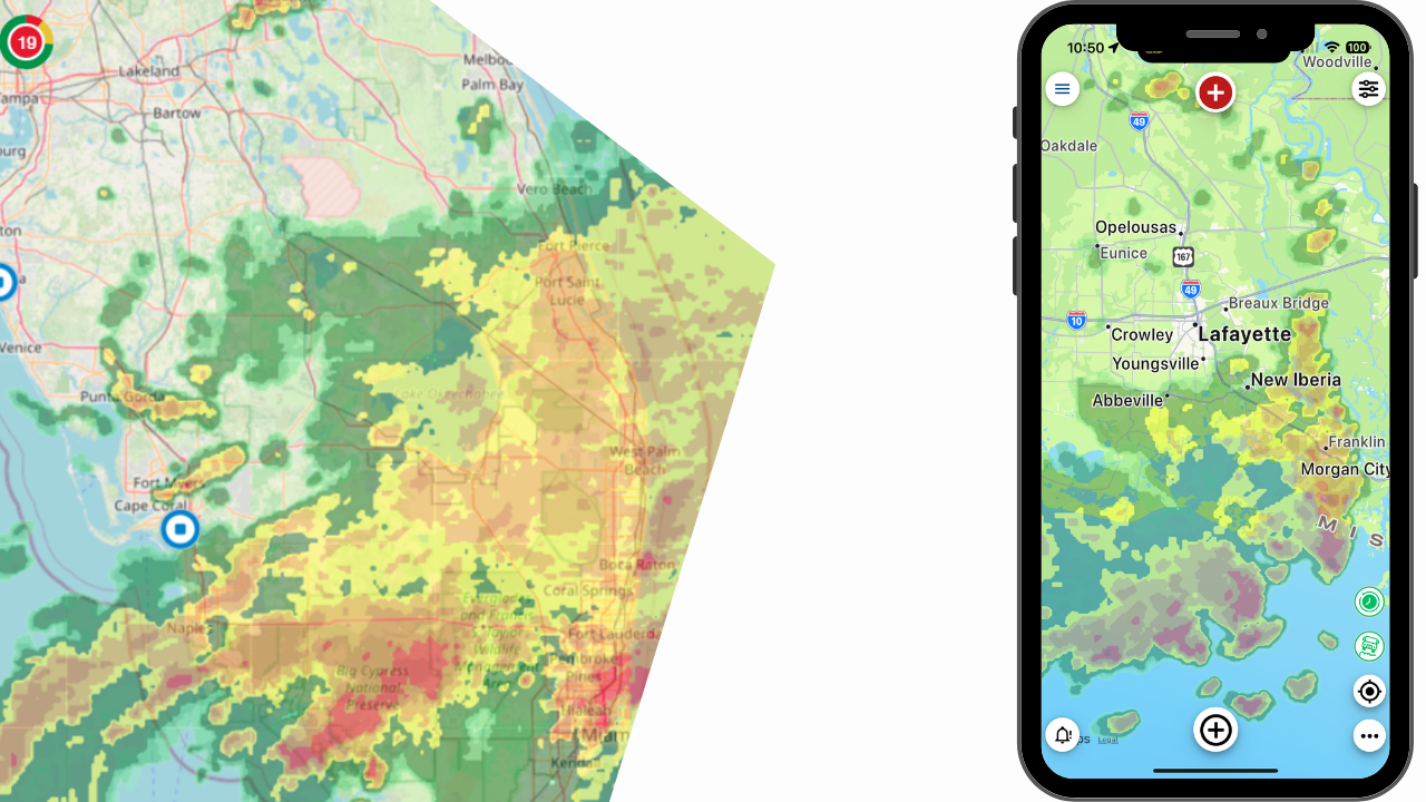
Radar, Futurescan
Comprised of a complete nationwide image of radar data, this product offers a composite of precipitation across the United States. A precipitation mask is applied to the display, allowing users to distinguish between areas of rain, freezing mixes, and snow, and gauge the intensity of each. Information is updated every 2.5 minutes. This product is a situational awareness tool suitable for any kind of application. For more detailed and precise precipitation analysis, Super-Res and High-Res Radar products are ideal.
- Resolution: 2 km
- Update frequency: 2.5 minutes
- Range: CONUS
Radar, Standard Canada
This product offers a composite image of precipitation across the majority of Canada. A precipitation mask is applied to the display, allowing users to distinguish between areas of rain, freezing mix, and snow, and gauge the intensity of each. Applications include determining severe and winter weather, identifying areas of potential flooding, and assessing road travel and other weather-related threats to human life and property.
- Resolution: 2km
- Update frequency: 10 minutes
- Range: Canada
Radar, Standard US
Comprised of a complete nationwide image of radar data, this product offers a composite of precipitation across the United States. A precipitation mask is applied to the display, allowing users to distinguish between areas of rain, freezing mixes, and snow, and gauge the intensity of each. Information is updated every 2.5 minutes. This product is a situational awareness tool suitable for any kind of application. For more detailed and precise precipitation analysis, Super-Res and High-Res Radar products are ideal.
- Resolution: 2 km
- Update frequency: 2.5 minutes
- Range: CONUS
♦Road Conditions (Current Road Conditions)
For those who need to make driving and operational decisions based on current road conditions, this product displays whether roads are wet, flooded, or affected by ice or snow. Poor road conditions due to weather are a leading cause of traffic accidents and many organizations rely on road condition reports to make operational decisions. Applications include all forms of ground transportation, emergency personnel preparedness, and validating insurance claims. Road weather products are also ideal for display and alerting applications in onboard telematics systems.
- Resolution: 7 km
- Update frequency: 1 minute
- Range: CONUS
♦Roadway Threats (Current Roadway Threats)
For those who need to make driving and operational decisions based on current road conditions, this product displays whether roads are wet, flooded, or affected by ice or snow. Poor road conditions due to weather are a leading cause of traffic accidents and many organizations rely on road condition reports to make operational decisions. Applications include all forms of ground transportation, emergency personnel preparedness, and validating insurance claims. Road weather products are also ideal for display and alerting applications in onboard telematics systems.
- Resolution: 7 km
- Update frequency: 1 minute
- Range: CONUS
Temperature (Current North American Temperature Map)
Useful for general weather observation, determining extreme temperatures, and assessing general weather conditions, this product provides the temperature of the air near the surface of the earth.
- Resolution: 10 km
- Update frequency: 20 minutes
- Range: CONUS
Temperature, Heat Index (Current North American Heat Index Temperature Map)
The heat index value is derived when the apparent temperature is higher than the air temperature, taking into consideration humidity as well as temperature. Applications include weather forecasting, particularly determining extreme temperatures that pose risks to human health and agriculture.
- Resolution: 10 km
- Update frequency: 20 minutes
- Range: CONUS
Temperature, Wind Chill (Current North American Wind Chill Temperature )
Wind chill value is derived when the apparent temperature is lower than the air temperature, taking into consideration wind speed as well as temperature. Applications include weather forecasting, in particular determining extreme temperatures and severe winter weather.
- Resolution: 10 km
- Update frequency: 20 minutes
- Range: CONUS
Threats, Current
For those who need to make driving and operational decisions based on current weather threats, this product provides information on hail, fog, lightning, moderate and dangerous winds, and tornadoes. Among its many possible applications are weather forecasting, fleet operations, and emergency personnel preparedness. Road weather products are also ideal for display and alerting applications in onboard telematics systems.
- Resolution: 7 km
- Update frequency: 1 minute
- Range: CONUS
Weather Observations (Current Conditions Airports)
Generated at airports globally, METAR data provides current conditions, including temperature, dew point, wind direction and speed, precipitation, cloud cover and heights, visibility, and barometric pressure. METAR reports are highly standardized and predominately used by meteorologists to generate forecasts and by aviation officials for pilot weather briefings. They can be used to provide real-time current conditions for any kind of application in your products and services.
- Resolution: airports
- Update frequency: as issued
- Range: Global
Wind, Surface Speed (Current North American Wind Speed Map )
This product provides recorded wind speeds above 10 mph, including gusts. Applications include weather forecasting, aviation and maritime operations, assessing the potential risk of property damage, validating insurance claims, and identifying areas of high winds that may impact daily activities.
- Resolution: 10 km
- Update frequency: 20 minutes
- Range: CONUS
Forecast Weather Layers
Precipitation Accumulation (HiRes)
Offering a forecast of total precipitation (rain, snow, sleet, etc.) accumulations for the next 96 hours, this product is useful in assessing the intensity of precipitation in an area. Applications include determining severe winter weather, identifying areas of potential flooding, and assessing general threats to human life and property. Covering the continental U.S. (and a bit beyond), this exclusive Baron model provides a very high 3km resolution.
- Resolution: 3 km
- Update frequency: 6 hrs
- Forecast: 96 hrs
- Range: Greater CONUS
Precipitation Rate (Forecast Radar Rainfall Accumulation)
This product is useful in assessing the total precipitation (rain, snow, sleet, etc.) rate at ground level. Applications include identifying areas of potential flooding, as well as assessing road conditions, and assessing general threats to human life and property. Covering the continental U.S. (and a bit beyond), this exclusive Baron model provides a very high 3km resolution and offers the most detail within a 96-hour forecast length.
- Resolution: 3 km
- Update frequency: 6 hrs
- Forecast: 96 hrs
- Range: Greater CONUS
Snow, Accumulation (Snowfall Accumulation)
Providing users with total expected snow accumulation, this product is useful for weather forecasting, in particular determining severe winter weather outbreaks, and assessing the snow’s impact on roads and runways. Covering the continental U.S. (and a bit beyond), this exclusive Baron model provides a very high 3km resolution and offers the most detail within a 96-hour forecast length.
- Resolution: 3 km
- Update frequency: 6 hrs
- Forecast: 96 hrs
- Range: Greater CONUS
Storm, Severe Probability
Produced by the U.S. Storm Prediction Center, this product projects the likelihood of severe weather elements, including flooding, hail, and wind shear, for the current day through day 3. Uses include severe weather forecasting, aviation operations, ground transportation, emergency preparedness, and assessing potential risks to human life and property.
- Resolution: 20 km
- Update frequency: Day 1 = 5x daily. Day 2 – 2x daily. Day 3-4 = 1x daily.
- Forecast: 24, 48, 72, 96 hrs
- Range: CONUS
Storm, Tropical (Official Tropical Track Forecast)
This data product is ideal for users who have a need to monitor the path of tropical cyclone systems, such as hurricanes and tropical storms. Applications include deployment in marine apps, or in products used by customers living along coastal areas. Tropical track forecasts are the US National Hurricane Center and Joint Typhoon Warning Center’s official prediction of a tropical cyclone’s path and intensity for the next five days. Each of these text products may be used independently or in conjunction with the corresponding tropical cone forecast tile product.
- Resolution: NA
- Update frequency: as issued
- Forecast: 120 hrs
- Range: National Hurricane Center
Wind, Speed & Direction (HiRes)
This product provides the wind speed (in knots) occurring at a specified elevation and time. It is ideally used in parallel with Wind Direction for a more complete view of weather situations. Its uses include general and severe weather forecasting, aviation operations, and assessing potential threats to property. The Baron Model’s high resolution, coupled with a 96-hour forecast length, makes this product a good choice for evaluating wind speeds with the highest available detail.
- Resolution: 3 km
- Update frequency: 6 hrs
- Forecast: 96 hrs
- Range: Greater CONUS
Storm, Spaghetti Model (Tropical Track)
Using multiple data models, this product only triggers when a tropical event is evident and gives users the ability to monitor the projected path of a tropical storm or hurricane. From these simultaneous tracks, trained users can identify how a storm may be trending. This critical weather information is useful for users living in coastal areas, recreational boating, commercial shipping, emergency preparedness, and assessing potential threats to human life and property in affected regions.
- Resolution: na
- Update frequency: as issued
- Forecast: 120 hrs
- Range: National Hurricane Center area
Road, Conditions
For those who need to make driving and operational decisions based on projected road conditions, this product displays the following road condition forecast parameters: flooded, slippery, patchy ice, ice, snow, and heavy snow. Applications include all forms of ground transportation, and emergency personnel preparedness. Road weather products are ideal for display and alerting applications in onboard telematics systems.
- Resolution: 1 km
- Update frequency: 1 hr
- Forecast: 72 hrs
- Range: CONUS